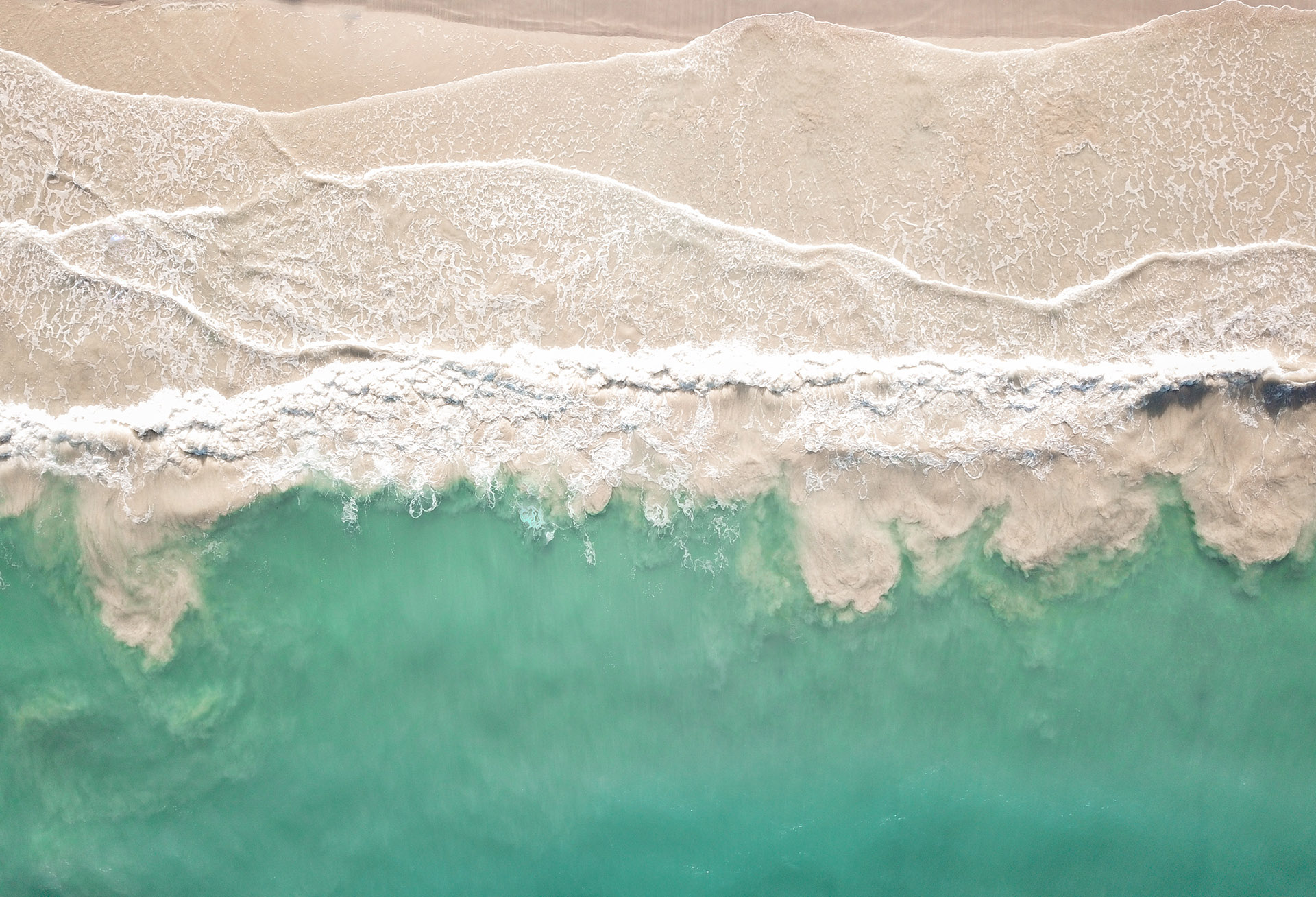
This project explores the pacific ocean and the search for glowing jellyfish. It was a true revelation of the glowing light of underwater creatures.
Location: Pacific Ocean
Camera: Campark ACT74 Action Camera
Lens: Ultra Wide Angle Lens
Shapes & Colors
That Make You Feel
Based in Europe, I have a passion for photographing compelling architecture that speaks to me, and hopefully you too!
Step into the wild
Ready for an adventure? Take a dive into my world of photography from exotic locations around the globe – from places like Zambia, Morocco, and more! All photos shot on the Canon EOS 5D. Feel free to reach out and connect with me!
Orner
World's Fastest
Better than any visual
It is a long established fact that a reader will be distracted by the readable content of a page when looking at its layout. The point of using Lorem Ipsum is that it has a more-or-less normal distribution of letters, as opposed to using.
It is a long established fact that a reader will be distracted by the readable content of a page when looking at its layout. The point of using Lorem Ipsum is that it has a more-or-less normal distribution of letters, as opposed to using ‘Content here, content here’
sleek Home design
Ancient Villa
About the Project
Integer blandit finibus dui ullamcorper fringilla. Nunc aliquam elit eu ultrices hendrerit. Suspendisse ultricies laoreet nibh sed molestie. Nunc lobortis, tortor vitae fringilla dapibus, eros ipsum imperdiet ipsum, eu convallis justo nisl mattis magna. Mauris pretium malesuada sodales.
Pellentesque habitant morbi tristique senectus et netus et malesuada fames ac turpis egestas. Sed vel rutrum sem. Sed ultricies purus ullamcorper blandit suscipit.
Nullam mollis rutrum iaculis. Fusce in ex a nisl posuere venenatis. Nullam ac mattis enim, quis tincidunt risus. Vestibulum a ullamcorper massa, a facilisis risus. Fusce tristique tellus dolor, nec posuere justo bibendum vel. In hac habitasse platea dictumst. Cras ac consequat lorem. Cras sodales diam eget nulla dignissim, non pellen tesque lacus consequat. Fusce volutpat erat non diam volutpat porta. Ut in augue laoreet risus gravida condimentum. Morbi elementum nibh libero, sit amet fringilla nunc cursus ac.
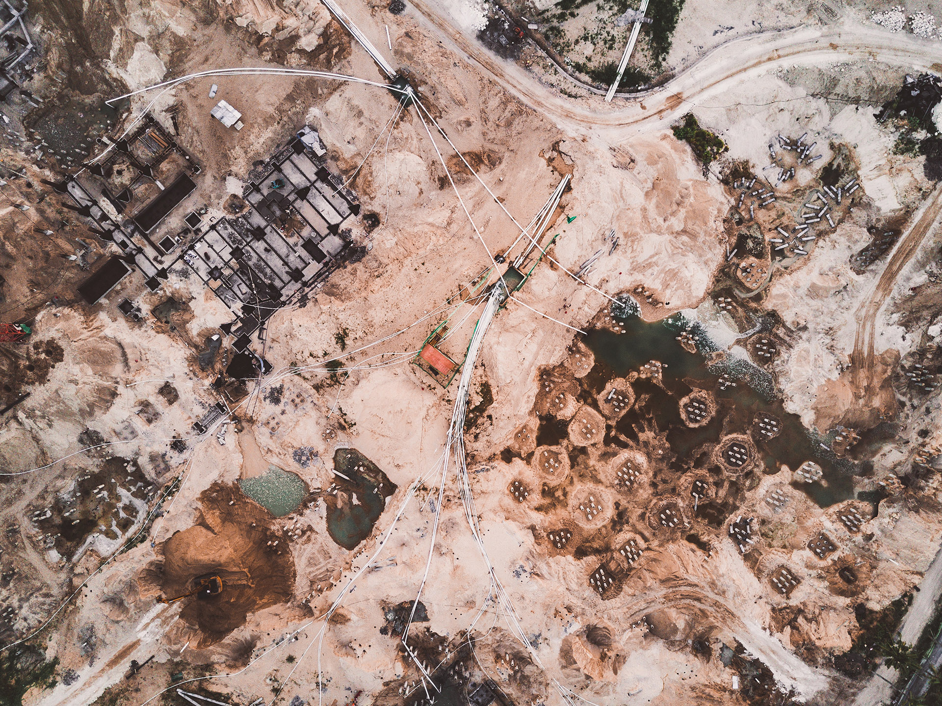
Release Date :
04 January 2024
Photographer :
Chantelle Flores
For Sale on :
The Gallery
Location :
African Desert
Project Overviews
Aliquam erat volutpat. Quisque tincidunt nunc erat, eget consectetur urna vulputate non. Donec ut est quis ligula lacinia interdum. Nulla quis gravida velit. In malesuada elementum magna nec laoreet. Pellentesque ac lobortis urna. Vestibulum eget finibus ligula. Aliquam pellentesque arcu eu neque malesuada, a fringilla odio blandit. Nullam tristique risus non nisl scelerisque gravida id ut tortor.
0+
Years Experience
0+
Animal Species
0+
Pro Photographer
0+
Pictures Taken
About Geowild
Capture the Priceless Treasure of Nature
Lorem ipsum dolor sit amet, consectetur adipiscing elit. Pellentesque at malesuada urna. Sed vel hendrerit metus. Etiam posuere nunc id arcu condimentum varius ut ac velit. Proin eleifend ac nunc varius ornare. Vivamus vel bibendum erat.
See what you would look like wearing different glasses from the comfort of your home. Capture your favorite looks, share them with your friends for a second opinion, and shop online for your perfect pair with confidence.
Photojournalism-styled images are our signature. We want our work to move people emotionally in addition to being visually beautiful.
I am slide content. Click edit button to change this text. Lorem ipsum dolor sit amet, consectetur adipiscing elit. Ut elit tellus, luctus nec ullamcorper mattis, pulvinar dapibus leo.
Firstname SurnameJob Title
I am slide content. Click edit button to change this text. Lorem ipsum dolor sit amet, consectetur adipiscing elit. Ut elit tellus, luctus nec ullamcorper mattis, pulvinar dapibus leo.
Firstname SurnameJob Title
I am slide content. Click edit button to change this text. Lorem ipsum dolor sit amet, consectetur adipiscing elit. Ut elit tellus, luctus nec ullamcorper mattis, pulvinar dapibus leo.


